
Image

The Second Volume in a series of Atlases relating to the voyages of Captain James Cook consisting of maps and engraved illustrations of landscapes and people.
We have recently digitised these atlases, and with further study through an Inclusive Global History lens, we hope to shift our interpretation’s focus from the atlas itself to the people and places it portrays.
Here are some pages from the second volume in the series of atlases (BELUM.C5488).
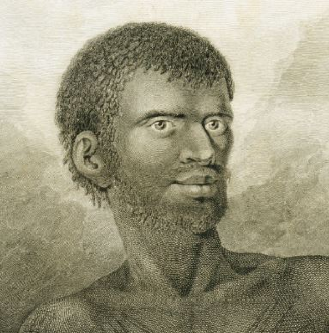
This print currently on display in our Modern History gallery features an Aboriginal man from Tasmania whose name is not recorded. Following Cook's voyages, lands in Tasmania were colonised by the British in 1803. The Aboriginal population was almost completely decimated.


